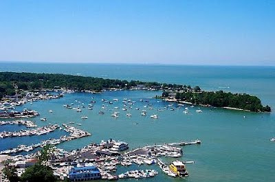
Lake Erie & Vermilion River
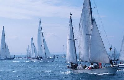 The Vermilion River, which flows into Lake Erie, endows marina facilities with more than 1,000 boat slips and ramps for easy access to the Lake, earning Vermilion the title of the “Largest Small Boat Harbour on the Great Lakes.” Lake freighters are a regular sight on Lake Erie making their way through the Great Lakes.
Lake Erie Islands
 Did you know you could escape to an island, just off the shores near Vermilion? The islands are a Midwest vacation hot spot. Just a short drive to a ferry ride from the mainland, or visit by boat, and you’ll forget you are in Ohio! Whatever your pleasure, coastal relaxation or on-the-go excitement, the islands have got it covered! And it’s all just minutes away from historic Vermilion, Ohio.
The Lake Erie Islands are a chain of archipelagic islands in Lake Erie. They include Kelleys Island, Pelee Island, the Bass Islands, and several others. The majority of these islands are under the sovereignty of Ohio in the United States. Pelee Island is the only major island administered by Ontario, while the smaller Middle Island is the southernmost point in Canada. Most islands that are large enough are popular tourist attractions with car ferries running from the mainland and between some islands and some small airports and numerous private marinas offering other ways to reach the islands.
Kelleys Island, listed on the National Register of Historic Places, is an outdoor-lovers paradise, while Put-in-Bay, on South Bass Island, appeals with abundant shopping and entertainment. You can also visit Middle Bass Island, which is dominated by vineyards, old homes, summer cottages, and a campground. Canada’s Pelee Island is also accessible by ferry from Sandusky, but does require planning for an overnight stay – the ferry visits Sandusky only once a day in peak season.
The Lake Erie Islands can only be reached by boat or plane. Cars are permitted on all the islands; however, you’ll have greater freedom to discover each island’s natural beauty by bicycle or golf cart. Rental shops are located within walking distance of the islands’ ferry docks.
Kelleys Island is a nature-lovers’ paradise, whose modest commercial development lends to its appeal. Rent bicycles or golf carts to explore the scenic countryside, visit the largest prehistoric glacial grooves in existence, catch a bite to eat at an island eatery, or simply lounge at the Kelleys Island State Park beach. The island’s appeal ranges from natural spaces to rousing nightlife. Birds, wildlife, and hiking trails are abundant,. Enjoy miniature golf, volleyball, horseshoes, one-of-a-kind island shops and confectioneries, and making memories that will last a lifetime.
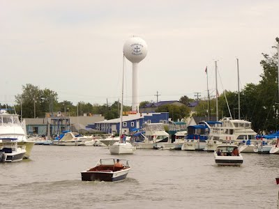
Municiple Boat Ramp
South Street Municipal Public Boat Ramp
 Phone: (440) 204-2474
Location: The boat ramp is located on the west side of the Vermilion River, and is adjacent to the Water Pollution Control Center. Directions from Rt. 6: On the west side of the bridge over the Vermilion River, by Convenient Food Mart, turn south onto West River Road. Then in about ¼ mile at the stop sign, turn left (east) onto the Boat Ramp access road. Watch for oncoming traffic on West River Road from the south which does not stop and has the right of way. Directions from Rt. 60: From the traffic light where State Rt. 60 intersects South Street, turn right (east) onto South Street and go east about ½ mile. Where South Street dead-ends at West River Road, there is a stop sign. At this intersection, watch for traffic coming from the right (south) which does not stop and has the right of way. Cross the street by making a jog to the left (north) onto West River Road, then immediately turn right onto the access road leading downhill to the river and Boat Ramp.
Fees: $7 Launch Fee
- 2 ramps
- 2 courtesy docks
- car top and canoe launch area
- trailer and car parking
- disabled & handicap accessible facility
- open 24 hours from mid April to mid November
- bait and fishing supplies available from local suppliers
- minutes north to Lake Erie no dockage available